Updates Coming Soon!

Thanks for visiting Darrell's Hiking Page. I've been keeping this web site around for sentimental reasons, however it badly needs some updates. Now that I have moved to Roanoke, perhaps I can start exploring the trails in the area. Stay tuned!

Ramsey's Draft

Posted by Darrell on May 04, 2015

Located in the George Washington National Forest (GWNF) west of Staunton, this site has nicely developed picnic and parking areas maintained by the Forest Service. The main trail goes into a wilderness area and has moderately difficult terrain.

The trail crosses water on several occasions (15 times at last count) and some areas have been eroded away by recent floods. Also, several large trees have fallen across the trail and at times it becomes difficult to find the path. So, for these reasons you should be have sturdy hiking boots and extra socks. One word of caution: don't try this trail alone if you get lost easily.

Directions: Take exit 225 off Interstate 81 and go west on VA 275 (Woodrow Wilson Parkway). This by-pass takes you to US 250, where you would turn right and proceed west. Pass through Churchville, VA and go about 10 miles where you enter the GWNF. The Ramsey's Draft recreation area is clearly marked on your right hand side.

St. Mary's Wilderness

Posted by Darrell on May 04, 2015

This area could have a web site all it's own because there are so many ways to hike through it. First, I highly recommend getting one or more maps to help navigate. The Forest Service has published "Recreation Guide R8-RG 49" or purchase PATC Map 12 "Rockfish Gap to Tye River Gap" at any good hiking supply store.

There are two approaches, first let's look at it from the Blue Ridge Parkway. The Mine Bank Trail descends from the Parkway down into the wilderness area. This hike is what I call "from the top down," in other words, you're hiking down from a higher elevation. Just remember to have plenty of food, water and allow extra time to hike back up to your starting location.

There is an entrance for the parking area a few yards from the Fork Mountain Overlook, mile marker 23. At the trail head is a bulletin board maintained by the Forest Service. Be sure to stop and look at any announcements or restrictions posted. The trail drops about 2 miles, passing by an old abandoned manganese mine, and meets with the St. Mary's Trail.

The other way to enter the wilderness area is from the Valley. Go south from Stuarts Draft on VA 608 to Forest Service (FS) road 41. You'll know that you're getting close when you see the Mt. Joy Church and cemetery. The FS 41 takes you into the George Washington National Forest and comes to a small parking area and trail head. From here you can hike to your heart's content, since the St. Mary's Trail goes for several miles into the wilderness. Camping is allowed so that you could backpack in for the weekend. Be sure to check the bulletin board for any posted announcements or restrictions.

Dark Hollow Falls

Posted by Darrell on May 04, 2015

Located in the central district of the Shenandoah National Park, Big Meadows has a campground, visitor center and picnic area.

You can make a great circuit hike by starting at the picnic area and taking the nature trail to Dark Hollow Falls Trail. This trail descends along the Rose River for about 2 miles (of course, enjoy the falls along the way) and comes to a fire road. Take the fire road back up about 1 mile to the Skyline Drive. Cross the road to Fishers Gap and at the edge of the parking lot is another fire road that will intersect with the Appalachian Trail (AT). Turn left and take the AT back to Big Meadows. The entire loop is approximately five miles.

Big Run Loop Trail

Posted by Darrell on May 04, 2015

Big Run Loop Trail connects with other trails and can be used to make several different circuit hikes of various lengths. Both ends of the trail are accessible from Skyline Drive and have nearby parking areas.

We started out on a rather chilly March afternoon at the Browns Gap parking lot. Before starting the hike, we parked a second car at the Big Run Overlook so that we could ride back to our starting point. However, if you get started early enough, one can make a nice 6-7 mile circuit hike by walking back along the Appalachian Trail (AT).

Group photo

From left to right: Shawn, Kathy, Darrell and Bernie

Not pictured: Nancy, our hike photographer
(thanks for the photos, Nancy)

At Browns Gap, the AT crosses Skyline Drive, and it was from the parking lot that we proceeded north. Hiking along the AT for about a half mile, we came up to the cement post that marks the trail head for the Big Run Loop Trail. We turned left to head towards Big Run, leaving the famous AT behind. It wasn't long before we came up to an area of dead oak trees, presumably killed off by the gypsy moths that have been invading the park. There were several felled trees across the trail. Fortunately, the park rangers had already been there to cut away the debris.

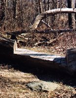
Sometimes the rangers get a little creative.
Here they cut out a nice step to walk over the fallen tree that was blocking the trail.

Step cut-out

After about another half mile, the trail comes to a 4-way intersection. Straight ahead is Rockytop Trail, to the left is a short spur that goes to the Madison Run Road and back up to the parking lot. To stay on our course to Big Run, we turned right and proceeded down.

Overlook
Before long, we came to a large boulder beside the trail. This is one of my favorite places to stop and rest and there is a nice view to the northwest.


After a short break, we continued following the trail. A couple of sharp turns (switchbacks) later, we arrive at the bottom and Big Run.

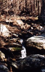
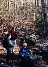
Stream Taking a break

A really nice place to stop, have a picnic lunch (be sure to pack out your trash), take photos and enjoy the tranquil sounds of the running stream. Here also is the junction with the Big Run Portal Trail.

After making sure we were on the right trail, we walked across some stones to cross the river and began our journey back up.
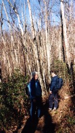
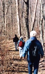
Hiking back up

The trail climbs up and then goes along a ridge. It is over 2 miles back up to the Big Run Overlook where we had parked our other vehicle.

Hiking along the ridge


Stopping occasionally to rest, we hiked along until we got to some sharp switchbacks and then reached the Skyline Drive.